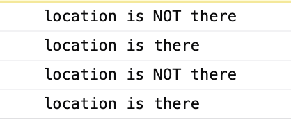
Today MQTT was integrated into the map, and the basic MQTT topic structure was decided. Basically, devicename/latitude, with the data being that value. The navigation controls were added to the map by modifying mappa.js with the correct Mapbox GL function. Tests were completed to detect the lat & lon from mouse location, the current zoom level, and if that lat & lon is visible. This will be useful for unloading / loading devices. The next step is to make a python program that loops through a Bowie log and sends the data over MQTT to AWS.
Archives
- March 2021 (2)
- January 2021 (2)
- December 2020 (10)
- November 2020 (7)
- October 2020 (12)
- April 2020 (5)
- March 2020 (11)
- February 2020 (18)
- January 2020 (23)
- December 2019 (18)
Categories
- Announce (1)
- Environment (1)
- News (107)
- Collaboration Logs (14)
- Field Logs (1)
- Progress Logs (53)
- Tech Logs (38)
Tags
aframe
ar
arduino
aws
aws iot
bowie
brain kit
build
cad
chassis
code
collab log
data
documentation
ec2
electronics
esp32
Field Log
imagery
ir camera
javascript
jitsi
kit code
kit log
leds
map
marker
microcontroller
mosquitto
motor kit
mqtt
operator interface kit
outdoors
power pack kit
python
schematic
sensor node
software
ssl
super bright lights kit
team
tech log
testing
uottawa
water
